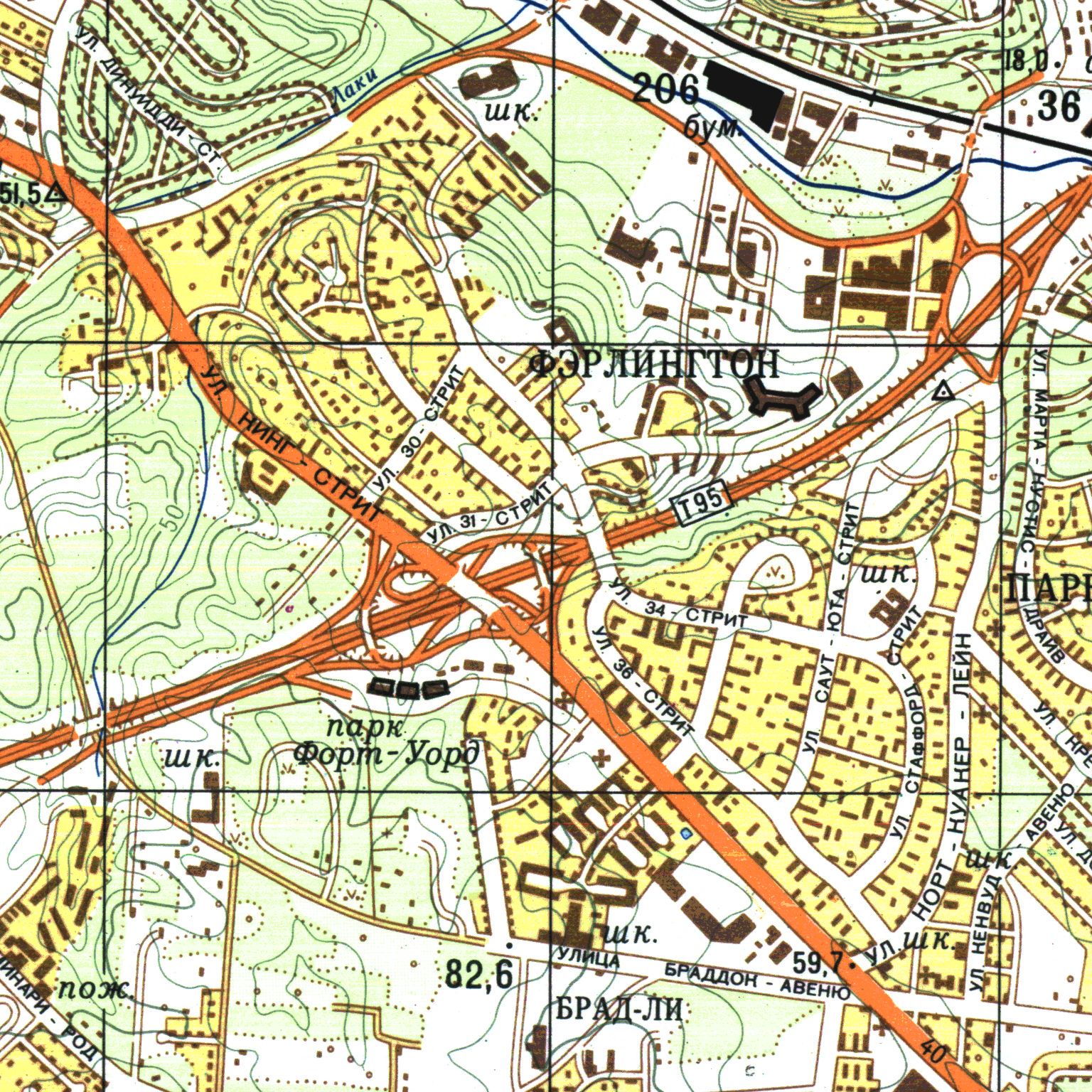
During the Cold War, the Soviet Union used publicly available atlases, satellite information, and human intelligence to create detailed maps of many cities in the United States. Washington, DC and its environs, including Fairlington, were among those included in this mapping project. Many of these maps were sold to curious Westerners after the rapid collapse of the Soviet Union. It is now possible to view them on redatlasbook.com.
The Soviet map of Fairlington, dating from 1975, is very detailed. Individual roads are correctly labelled in Russian, along with the neighborhood as a whole (“Фэрлингтон”). Some individual residences are included, and some courts are recognizable. The distinctive shape of certain buildings, like Shirlington House and Fairlington Elementary School (now the Fairlington Community Center) are more or less faithfully portrayed.
The high level of precision and accuracy draw attention to the few errors that are present. Residences are shown on the south side of 32nd Rd S, in the forested area next to the present-day Fairlington Park, where there have never been any residences. While Fairlington Elementary is properly labelled as a school (“шк”), Abingdon Elementary is not, but the now-demolished Claremont Plaza Shopping Center is. (The shopping center was located at the southern corner of South Walter Reed Drive and South Arlington Mill Drive, where the Heatherlea condominiums are now.) Finally, a bridge is shown connecting S Abingdon Street and S 28th Street, which actually existed in Fairlington’s first years but had been removed about ten years before the map was published.
Collectors of Soviet maps can only hypothesize about their purpose, as they are still classified in Russia and so first-person testimony from their creators is unavailable. Among other uses, the maps would have proven useful in an invasion and occupation of the United States.
You can read more about these maps in the book The Red Atlas: How the Soviet Union Secretly Mapped the World by John Davies and Alexander J. Kent. The maps were also the subject of a Wired Magazine article. The southwest quadrant of the DC-area map can be explored in its entirety here.